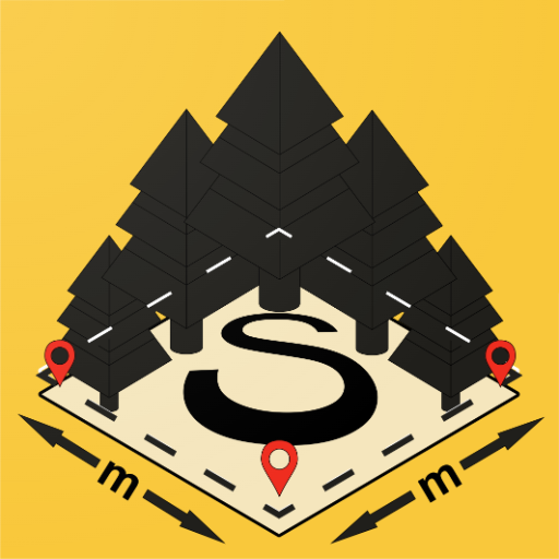

Features GeoAbris: измерение площади
Ideal for solving problems in forestry and agriculture.Opportunities: - Create a drawing (outline) by bearings and azimuths - Design a landfill, a logging area (cutting area), a branch - right on the ground - Control the residual and calculate the area - Make changes to the project, edit or delete the result - Get coordinates to the created object both manually and by assignment on the ground using GPS.
Polygon can be georeferenced - Load raster (map, tablet, space image) - Save to shp file and open in GIS - Make the result into a map and save it as PDF for later printing.
- Convert rumba, azimuth and coordinate values on the fly.
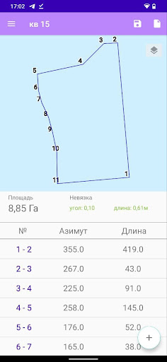
- Unique compass with bearing and bearing.The application works in three modes:1 Mode - a polygon (outline) is drawn based on the values of bearings or azimuths and lengths of lines.
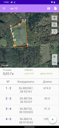
The out-of-bounds (error) and the area of the polygon are shown.2 Mode - if you have the Internet, upload space images to the area of interest.
Navigate the terrain using GPS.
Calculate coordinates for the polygon (plot / cutting area).3 Mode - Open the raster background (map, tablet, satellite image) and draw using the built-in GeoAbris tools.
Rumba or azimuths and side lengths will be calculated automatically.GeoAbris allows you to form annex No.
4, 5 to the Forest Declaration in accordance withby order of the Ministry of Natural Resources and Environment of the Russian Federation dated April 29, 2021 No.
303 "On approval of the forest declaration form, the procedure for filling and submitting it, requirements for the format of the forest declaration in electronic form."Appendix 4 to the forest declaration form provides a scheme (s) for the location of the cutting area, forest infrastructure facility, timber processing infrastructure facility and facility not related to the creation of forest infrastructure.Appendix 5 to the forest declaration form for each cutting area, object of the declared period, shown in the layout (s) in Appendix 4 to the forest declaration form, indicates: number of the cutting area, object;- area (total), ha- area (operational), ha- a catalog with the numbers of characteristic points (pillars) at the corners of the cutting area (object), the distance between them (length of lines, m), magnetic azimuths (points) of lines (direction of lines)- catalog of coordinates of characteristic points (pillars) at the corners of the cutting area (object) in the WGS-84 coordinate system; binding the cutting area to quarter pillars, clearings or other permanent landmarks.The accuracy of determining coordinates on the ground depends on your device.
Fitness Tracking
Track your workouts and monitor your health metrics.
Learning Tools
Enhance your learning experience with interactive features.
Travel Features
Plan and manage your travels with ease.
See the GeoAbris: измерение площади in Action
Get the App Today
Available for Android 8.0 and above